The rig stalls halfway through the bore: the ground should have been surveyed first, not discovered mid-drive
8 min read
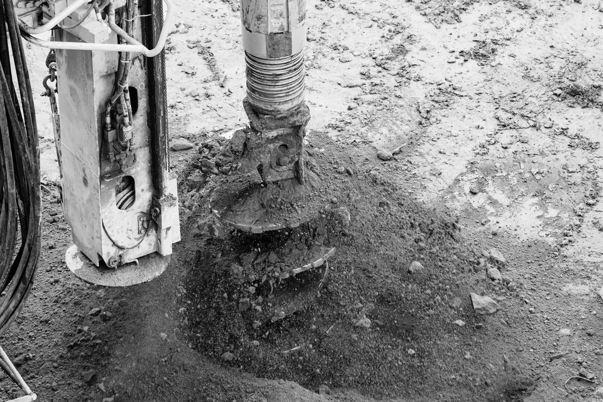
The horizontal rig is halfway through the fourth crossing of the morning, under a provincial road the specification forbids cutting open. The drilling fluid stops returning, the load on the head spikes: nobody knew there was a band of cemented gravel under the asphalt. On the designer’s desk that morning sat the utility map — not a cross-section of the subsoil. The Recommendation that would have asked for exactly that piece of information is twenty-six years old and free to read; but searching for it under the designation it carries today lands on a page with nothing to download.
Two Recommendations, four designations
Behind this sits a pair of ITU-T Recommendations in the L series, both free of charge: L.152, Use of trenchless techniques for the construction of underground infrastructures for telecommunication cable installation, and L.257, Investigation of the soil before using trenchless techniques. The ITU-T site lists both as “In force”, each with a single edition — L.152 (09/99), L.257 (05/00) — never technically revised since.
Here the renumbering trap springs, checked directly on the ITU-T pages. L.257’s own page carries the note in full: “Former ITU-T L.39 renumbered as ITU-T L.257 on 2016-02-15 without further modification and without being republished.” The same sentence, with L.38 and L.152 swapped in, sits on the historical L.38 (09/99) page — but not on the current L.152 page, which states only “In force” with no mention of the renumbering. That is an asymmetry in the ITU-T catalogue itself, not an oversight on our part: we report it as it reads on each page.
The consequence sits one level lower than it appears: none of the four recommendation pages links to the document at all, because each points to an edition page instead. That is where the two branches part. The editions T-REC-L.38-199909-I and T-REC-L.39-200005-I offer the PDF; their twins T-REC-L.152-199909-I and T-REC-L.257-200005-I respond, and offer nothing. The file comes from the first pair, through dologin_pub.asp?lang=e&id=T-REC-<edition>!!PDF-E&type=items, with that page set as Referer. Anyone citing L.152 or L.257 cites the text approved on 24 September 1999 or 12 May 2000, never touched since.
What to know about the ground, before choosing
L.257 does not describe drilling techniques: it describes what to gather before picking one. From clause 2 onward: “Right from the first design phase, it is essential to acquire all the available information about the existing utilities and the nature of the ground on site.” That information falls into three categories, not one general checklist: “statutory/administrative; technological (e.g. presence of utilities or obstacles); geolithological, hydrogeological and geotechnical.” A specification that fills in only the first of the three — usually just the utility map — leaves the other two blank.
On method, clause 3.2 sets an economic principle before a technical one: a geological investigation “should contain available bibliographical knowledge of the area and also information taken from an on-site investigation.” The techniques split into direct methods — boring, trial excavations, soundings — and geophysical ones, which measure a property of the ground without digging. For ground-penetrating radar, L.257 goes down to the antenna frequency, recommending “medium frequency antennas (400-600 MHz) to reach an investigation depth up to 2 metres and low frequency antennas (100-200 MHz) to reach investigation depths up to 3 metres”. That is a threshold a survey report should state outright, not leave to whichever antenna is on the van.
The final product is not only the position of the utilities that were found: it is also an honest account of where the survey never reached. “In order to avoid risks, the end user of the utility map should be made aware of this lack of information.” Areas that could not be surveyed — blocked by an obstacle, by traffic, by a permit that never came through — have to be marked on the map, not silently dropped from it. A map with no declared gaps is not a more complete map: it is a map that hides where it never looked.
The technique chosen for the ground, not the quote
This is where L.152 picks up the work L.257 has already done. Clause 8.1 ties the choice of technique directly to the ground actually surveyed: “In general, homogeneous clays are the most favourable soils.” “Sand can present problems especially if it is below the water table or is not self-supporting.” Gravel can be bored through, but it wears the head down fast; there, the Recommendation requires drilling mud to hold the walls of the bore. Table 2 then maps each ground type — silt and clay, gravel and marl, limestone, sandstone, granite — onto a specific drilling technique.
The same field logic runs down to the geometry of the pilot bore itself. For aligning the machine at the starting point, clause 5.1 sets a limit that almost no Italian specification ever cites — “This angle should not exceed 20°” — for the angle of incidence of the first rod against the ground. Going past it forces the drilling machine further back from the starting point — a site measurement, not a theoretical principle.
When the ground has not been read, L.152 documents the consequence as a recurring failure mode: describing pipejacking, Appendix I records that on early sites “This could lead to early pipe failures as the maximum load bearing capacity of the pipes was exceeded in difficult conditions.” It is the same pattern as the stalled rig at the start: the technique fails not from a manufacturing defect but because nobody measured what it would have to push through.
The record that survives the backfill
Clause 7, on record keeping, lists what a drilling log has to contain for every section, including “drilling data such as depth, angle and rate of penetration and utility crossings.” That is not a closing certificate signed once the job is done: it is a running record, section by section, written while the rig is still advancing.
What to write into the specification
- Require a soil investigation report covering the three L.257 categories — statutory, technological, geolithological/hydrogeological/geotechnical — before authorising any trenchless technique.
- Demand a direct on-site survey, not just archive records: a locator for metallic utilities, radar at a frequency stated against the depth required, and soundings where the radar is not enough.
- Require the chosen technique to be declared against the ground actually surveyed, referencing the L.152 classification — not a generic controlled horizontal directional drilling.
- Require a drilling log for every section: depth, angle of incidence, rate of penetration, ground conditions encountered, utility crossings.
- Require the final map to show the areas never surveyed, not omit them.
How to check it at acceptance
Acceptance checks the drilling log against the survey report that preceded it: does the declared technique match the ground encountered, does the angle at the starting point stay within the 20° limit, does the final map still show the areas never surveyed. If the log is missing, or records only depth with no angle and no ground conditions, the section cannot be checked at all: it has simply been buried.
What we haven’t verified
We have not verified whether the survey technologies described in L.257 — ground-penetrating radar, locators, electrical soundings — still reflect the state of the art on Italian sites today: the Recommendation was renumbered in 2016 but never technically updated, and its content still reads as it did in 2000. We have not found, anywhere on the ITU-T site, an explanation for the asymmetry between the two renumbering notes: we report it as read, not as our own interpretation.
The point
L.257 says what to know about the ground before drilling; L.152 says which technique to pick once that is known. Neither one mandates a report format or an acceptance threshold: that gets written into the specification, or it does not exist. That is the space we work in inside an optical network design engagement that starts from the ground survey, a specifications and compliance review that requires the log section by section, and the as-built documentation of a backbone for telecom operators. Survey report, log of every bore and declared technique feed into the same map, where an AI flags which section was drilled without one — within the client’s own perimeter, on-premises or on dedicated cloud with a data centre in Italy, alongside CSIDIA, the group’s other company.
About to open a trenchless site without a written ground survey, or facing a drilling log that came back incomplete? Talk to an engineer: the site visit costs nothing, and the ground-penetrating radar goes out before the rig starts turning, not after it has already stalled.
Sources
- ITU-T L.152 (09/99) — Use of trenchless techniques for the construction of underground infrastructures for telecommunication cable installation
- ITU-T L.38 (09/99) — historical edition, renumbered L.152 on 2016-02-15
- ITU-T L.257 (05/00) — Investigation of the soil before using trenchless techniques
- ITU-T L.39 (05/00) — historical edition, renumbered L.257 on 2016-02-15